Category:Interstate 70 in Utah
Jump to navigation
Jump to search
States of the United States: Colorado · Illinois · Indiana · Kansas · Maryland · Missouri · Ohio · Pennsylvania · Utah · West Virginia
section of Interstate Highway in Utah, United States  .svg) _map.svg) | |||||
| Upload media | |||||
| Instance of | |||||
|---|---|---|---|---|---|
| Part of | |||||
| Location |
| ||||
| Transport network | |||||
| Owned by | |||||
| Maintained by | |||||
| Start time |
| ||||
| Inception |
| ||||
| Length |
| ||||
| Terminus | |||||
| Partially coincident with | |||||
 | |||||
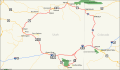
English: Media related to Interstate 70 in Utah, a main east-west corridor within eastern Utah, United States, that connects Interstate 15 in Millard County (south of Cove Fort) with Interstate 70, U.S. Route 6 and U.S. Route 50 at the Colorado Border (towards Denver), northwest of Grand Junction). Interstate 70 has brief concurrencies with U.S. Route 89 (in western Sevier County), and U.S. Route 191 (in northeastern Emery and northwestern Grand counties). The majority of Interstate 70 (east of Salina) runs concurrent with U.S. Route 50 and east of its interchange with U.S. Route 6/U.S. Route 191 (east of Green River) Interstate 70 also runs concurrent with U.S. Route 6.
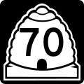
From 1962 to 1977, the new Interstate 70 in Utah was officially designated as Utah State Route 4 by the Utah State Legislature. Since 1977, it has been officially designated as State Route 70. From 1912 to 1962 the roadway along this corridor had been designated as Utah State Route 13.
From 1962 to 1977, the new Interstate 70 in Utah was officially designated as Utah State Route 4 by the Utah State Legislature. Since 1977, it has been officially designated as State Route 70. From 1912 to 1962 the roadway along this corridor had been designated as Utah State Route 13.
Subcategories
This category has the following 7 subcategories, out of 7 total.
*
U
Pages in category "Interstate 70 in Utah"
This category contains only the following page.
Media in category "Interstate 70 in Utah"
The following 11 files are in this category, out of 11 total.
-
 DinosaurDiamond map.svg 1,475 × 860; 769 KB
-
 I-70 (UT) map 2.svg 1,180 × 688; 69 KB
-
 I-70 (UT) map.svg 1,475 × 860; 349 KB
-
 I-70 (UT) Metric.svg 601 × 601; 15 KB
-
 I-70 (UT).svg 601 × 601; 15 KB
-
 Interstate 70 in Utah map.png 2,205 × 1,286; 52 KB
-
 OldSpanishTrailUT.gif 765 × 600; 84 KB
-
 Utah 4.svg 600 × 600; 10 KB
-
 Utah 70.svg 600 × 600; 11 KB
-
 Utah SR 4.svg 385 × 385; 5 KB
-
 Utah SR 70.svg 385 × 385; 8 KB

_map_2.svg)
_Metric.svg)


